



Search results for "a."
Items in stock - 4 working days delivery time

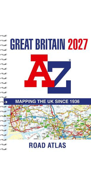
Great Britain A-Z Road Atlas 2027 (A4 Spiral)
Navigate your way around Great Britain with this detailed and easy-to-use A-Z Road Atlas A spiral bound, full-colour road atlas, now fully revised and updated. Clear detailed road mapping at a mainland map scale of 3.5 miles to 1 inch. Published in an easy-to-read A4 size. This essential road atlas includes:• 11 pages of main route mapping covering Greater London, Birmingham and Manchester• Route planning maps• Mileage chart with average journey times• 80 city and town centre street plans• 16 port and airport plans• Channel Tunnel terminus maps• Index to cities, towns, villages, hamlets, major destinations and selected places of interest with postcodes for sat-nav use• Map reference information also in French and German Instantly recognisable and easy to use, A-Z road mapping includes the following features: clear standard road classification colours for easy identification, full motorway junction detail, under construction and proposed roads, primary route destinations, service areas, selected truck stop locations, national and county boundaries and a wide range of tourist and ancillary information, including Blue Flag Beaches. A portable sized publication with a spiral binding; a popular choice for those wanting superb map clarity.
R 465.00
Great Britain A-Z Road Atlas 2026 (A4 Spiral)
Navigate your way around Great Britain with this detailed and easy-to-use A-Z Road Atlas A spiral bound, full-colour road atlas, now fully revised and updated. Clear detailed road mapping at a mainland map scale of 3.5 miles to 1 inch. Published in an easy-to-read A4 size. This essential road atlas includes:• 11 pages of main route mapping covering Greater London, Birmingham and Manchester• Route planning maps• Mileage chart with average journey times• 80 city and town centre street plans• 16 port and airport plans• Channel Tunnel terminus maps• Index to cities, towns, villages, hamlets, major destinations and selected places of interest with postcodes for sat-nav use• Map reference information also in French and German Instantly recognisable and easy to use, A-Z road mapping includes the following features: clear standard road classification colours for easy identification, full motorway junction detail, under construction and proposed roads, primary route destinations, service areas, selected truck stop locations, national and county boundaries and a wide range of tourist and ancillary information, including Blue Flag Beaches. A portable sized publication with a spiral binding; a popular choice for those wanting superb map clarity.
R 455.00

Items we need to order for you
R 672.00
R 428.00
R 305.00
R 305.00
R 360.00
Northern England A-Z Road Atlas
Find your way around Northern England with this fully revised and updated road atlas. A full colour regional road atlas featuring 52 pages of road mapping. Covers an area extending to: Berwick-upon-Tweed, Newcastle upon Tyne, Middlesbrough Kingston upon Hull, Grimsby, Boston, Nottingham, Stoke-on-Trent, Wrexham, Chester, Liverpool, Blackpool, Barrow-in-Furness, and Dumfries The road mapping is shown at a clear 3.5 miles to 1 inch scale (2.2 km to 1 cm) and includes the following features: Motorways open with full junction detail, motorways under construction and proposed, service areas, primary routes and destinations, A & B roads, selected minor roads, gradients 1:5 and steeper, tolls, mileages, county boundaries, spot heights and hill shadingSelected safety camera locations with their maximum speed limitsSelected fuel stationsNational Park boundariesSelected places of interest, tourist information centres and golf courses Also, within this Northern England Road Atlas are 24 city, town, airport or port plans for: Blackpool, Bradford, Carlisle, Chester, Derby, Dumfries, Durham, Harrogate, Kingston upon Hull, Leeds, Lincoln, Liverpool, Manchester, Middlesbrough, Newcastle upon Tyne, Nottingham, Preston, Sheffield, Stoke-on-Trent, Sunderland, York, Manchester Airport, Kingston upon Hull Port, and Newcastle upon Tyne Port The index section lists cities, towns, villages, hamlets and locations covered by this atlas.
R 251.00
R 336.00
R 521.00
Edinburgh A-Z Street Atlas
Navigate your way around Edinburgh with this detailed and easy-to-use A-Z Street Atlas. Printed in full-colour, paperback format, this atlas contains 45 pages of continuous street mapping. The main mapping extends beyond central Edinburgh at a scale of 3.33 inches to 1 mile, featuring postcode districts, one-way streets, park and ride sites, and safety camera locations. Areas covered include: South QueensferryLeithPrestonpansTranentMusselburghDalkeithBonnyriggLoanheadGorebridgePenicuikBalernoEdinburgh Airport The large-scale street map of Edinburgh city centre – at a scale of 6.67 inches to 1 mile – includes: Places of Interest Guide, highlighting the city’s major tourist attractions and world-famous Edinburgh FestivalPostcode map of the Edinburgh areaRoad map of the Edinburgh areaDiagrammatic map of rail and tram connections A comprehensive index lists streets, selected flats, walkways and places of interest, place, area and station names. Additional healthcare (hospitals, walk-in centres and hospices) and transport connections (Edinburgh Tramway stops) are indexed as well.
R 283.00
R 428.00
R 257.00
R 360.00
Nottingham A-Z Street Atlas
Navigate your way around Nottingham with this detailed and easy-to-use A-Z Street Atlas. Printed in full-colour, paperback format, this atlas contains 74 pages of continuous street mapping. The main mapping extends beyond central Nottingham at a scale of 4 inches to 1 mile, featuring postcode districts, one-way streets, and park and ride sites. Areas covered include: Arnold, Beeston, Calverton, Carlton, Cotgrave, Eastwood, Hucknall, Heanor, Ilkeston, Keyworth, Long Eaton, Kimberley, Stapleford, West Bridgford. Separate coverage of Bingham is provided. A separate map is included for the Nottingham Express Transit Map at the back of the book. A comprehensive index lists streets, selected flats, walkways and places of interest, place, area and station names. Additional healthcare (hospitals, walk-in centres and hospices) and transport connections (Nottingham Express Transit) are indexed as well.
R 283.00
R 797.96
R 763.00
Manchester A-Z Street Atlas
Navigate your way around Manchester with this detailed and easy-to-use A-Z Street Atlas. Printed in full-colour, paperback format, this atlas contains more than 90 pages of continuous street mapping. Coverage extends to: Bolton, Bury, Oldham, Wigan, Rochdale, Salford, Stockport, Ashton-in-Makerfield, Altrincham, Ashton-under-Lyne, Cheadle, Leigh, Littleborough, Macclesfield, Ramsbottom, Stalybridge, Standish, Wilmslow. There is separate coverage of Knutsford and large scale city and town centre maps of:Manchester, Altrincham, Ashton-under-Lyne, Bolton, Bury, Oldham, Rochdale, Stockport, Wigan. Postcode districts, one-way streets and National Park boundaries are also featured on the mapping. The index section lists streets, selected flats, walkways and places of interest, place and area names, National Rail and Metrolink station names, hospitals, hospices and NHS Walk-in Centres.
R 283.00
TILT Diary of a Virgin Stripper
A woman who knows how to be in her own skin and embrace her sexuality is a magnetic force. She is a divine creature. A wildfire. She doesn't even have to be beautiful. It's the way she loves her body leaving her inhibitions behind. A woman like this can stop a man in his tracks with just a look. -A.A. Jones
R 586.00
R 605.90
R 547.56
R 214.00
R 284.00
Nottingham A-Z Pocket Street Map
Navigate your way around Nottingham with detailed street maps from A-Z This up-to-date, folded A-Z street map includes all of the 1,500 streets in and around Nottingham.As well as Nottingham Castle and Lace Market, the other areas covered include Willford Village, Dunkirk, the Meadows, New Lenton, Old Radford, Thorneywood, Alexandra Park, Aspley, Forest Fields, Highbury Vale and Woodthorpe. The large-scale street map includes the following:• Places of interest• Postcode districts, one-way streets and car parks• Index to streets, places of interest, place and area names, park and ride sites, national rail stations, hospitals and hospices The perfect reference map for finding your way around Nottingham.
R 126.00
R 184.00
R 458.00
R 306.00
R 183.00
A. P. Giannini
Perhaps more than any other individual, Amadeo Peter Giannini brought California into the twentieth century. Extending credit to ordinary working people, creating a financial empire through his branch banks, this son of Italian immigrants enabled California to advance faster than any other state in the decades before World War II. But who was A. P. Giannini? Felice A. Bonadio's superior biography reveals the founder of Bank of America in his many roles, most notably that of a bold, ruthless financial genius keenly aware of his minority status in a world dominated by the eastern Protestant elite.Yet this is more than the success story of an underdog. Bonadio profiles a man of immense talent who was relentlessly eager to serve "the people." Hard-driving, obsessive about defending his empire against its enemies, Giannini could be both a good hater and a good friend. He was one of the first American businessmen to promote employee ownership and profit sharing, and when he died in 1949 at age 79, nearly forty percent of B of A's shares were owned by its employees. Little interested in personal wealth, Giannini's own estate was modest at the time of his death.Much of Bonadio's research is from the private papers of Federal Reserve Bank officials and confidential Bank of America archives. Recollections of Giannini family members and former bank executives are also here, lending historical resonance and color to this portrait of a man whose influence endures many years after his death.Giannini prided himself on his compulsive work habits, which he justified with one of his frequently repeated aphorisms, "Be first in everything." Once, on horseback to solicit a consignment order from one of the valley's biggest growers, he suddenly spotted a competitor's team in the distance headed in the same direction. Remembering a deep slough that stood between him and the farm, he quickly cut across the field, tethered his horse to a tree, and swam to the other side. Then he ran the rest of the way to the farmhouse. By the time the other merchant had arrived, Giannini was negotiating a deal with the grower.
R 683.00
R 380.52
R 858.29
R 1,714.00
R 410.00
R 302.00
R 458.00
R 611.00
R 321.00
R 1,075.00
Great Britain A-Z Super Scale Road Atlas 2027 (A3 Spiral)
Navigate your way around Great Britain with this detailed and easy-to-use A-Z Road Atlas An easy-read, spiral bound road atlas, now fully revised and updated. Clear detailed road mapping at a mainland map scale of 2.5 miles to 1 inch. This big, easy to read map is published in a large A3 format. This large format road atlas includes:• 11 pages of main route mapping covering Greater London, Birmingham and Manchester• Route planning map• Mileage chart with average journey times• Information on motorway junctions with limited interchanges• 70 city and town centre street plans• 16 port and airport plans• Channel Tunnel terminus maps• Index to cities, towns, villages, hamlets, major destinations and selected places of interest with postcodes for sat-nav use• Map reference information also in French and German Instantly recognisable and easy to use, A-Z road mapping includes the following features: clear standard road classification colours for easy identification, full motorway junction detail, under construction and proposed roads, primary route destinations, service areas, selected truck stop locations, national and county boundaries and a wide range of tourist and ancillary information, including Blue Flag Beaches. A combination of a great map scale, large book size and a spiral binding makes this a popular choice for those wanting superb map clarity.
R 502.00
R 457.00


-
, by sungano kanjere Make a Wish...List!
Make and share your Exclusive Books Wish List to get the best gift you know you'll love. See a book you want to save for...
